Monday, September 28, 2015

Illinois Peak

This is a great way to enjoy a little peak bagging if you're a beginner. However,  I will say, the drive in is verrrrry long!  24 miles up Cedar Creek Rd., off I-90 at the Superior exit. A dirt mountain road that isn't especially fun, although it is a good road, just time consuming.  The journey is 4.3 miles up, with only an elevation gain of 1709 feet. I feel like I have to explain this, though.  The actual altitude gain from the beginning of the trail to the peak is just over 1200 feet. There are a few ups and downs on this trail, as you will see on the graph, which makes my navigation app add the ups as extra elevation gain.  I feel like this is justified in my overall elevation gain numbers. Either way, this was what I would consider on the easy side of hikes.  The great thing, though, and as usually is the case, is the beauty along the way! The hike traverses back and forth between several mountains, from one side to the other, which changes the scenery frequently. It's a lot different than just walking up a ridge line, which I've just realized, keeps your views pretty much the same.  And being able to do this in very late September is a wonder!  The colors are phenomenal right now, and we have had virtually no precipitation, which means I can still climb high without having to worry about boots and extra clothing.  In fact, the temperature is unseasonably warm, and I just couldn't ask for more. Hope it stays this way for another month or two before it just dumps on us!

You'll want to park when you see this sign.  The road acutally keeps going.  Probably to Idaho.
Be sure you walk up the trail that is left from the Stateline Tr. No. 738 sign.  I almost started walking up the wrong way, which would have made it a frustrating day.  The sign to follow (on the left) acutally shows the Illinois Peak trail to follow.

Missoula Lake.  Not sure why it's called that when it's so close to Superior.
Saw a LOT of elk tracks...wish we had seen an elk!


Another lake we walked by.  I believe it's one of a trio called Oregon Lakes.
Still have the sweatshirt on....it's a touch chilly in the mornings!


From the graph on the right, you can see how there were some ups and downs, which accounts for the altitude gain numbers. And, I was pretty pleased at the ease of it all, as my thighs were still burning from running down Little St. Joe Friday!


Thanks, again, for joining me on my journey! 


Little St. Joe

Little St. Joe was one of my favorite hikes from last year, and knowing it was shorter and closer to Missoula, the brief amount of time I had made this an optimal hike for Friday. In fact, I may have to make this one an annual trip.  The views of the mountain on the other side of Bass Creek are incredible! Then, right as you summit Little St. Joe, your entire view opens up onto some of the most breath taking sights the Bitterroot has to offer.  It excited me so much even though I've been here before.  It is that incredible! I'm only sad that the pictures do not do it justice....they never do.  This is why I cannot stress enough that you should be out there hiking it yourself.  You won't regret it!

 Two views of Little St. Joe from the road. If you look closely, you can see the top is covered in Tamaracks which are turning their beautiful shade of yellow.


 The start of the trail confused me each time.  There seem to be several going off in different directions.  It actually starts right off the road, as you can see my Jeep is parked right next to it.  There is a concrete bench with a plaque explaining the plane crash that happened up here.  If you read it, then look up, the trail starts over in that direction.  That is the best way I know to explain it, as I'm completely guessing when someone says,"it starts to the South," or whatever. I have a good sense of direction, and all, but not to that extent!


This beauty accompanies you pretty much the whole way up
Getting a glimpse of what you're about to climb


At about the 2 mile mark, you will have to rely on cairns more and more to follow any sort of trail. The higher I went my first trip up, the more often I had to stop and look for the next one.  It was a lot easier the second time.  Near the top is the memorial cairn that has quite a few plane pieces in it.  It's really the last one, and you can pretty much see from here where the summit is.  As you walk up, notice there are still pieces of the wreckage strewn about.  I think this is one of the things that makes this hike special.  It gives you a sense of being in a sacred place that should be respected.

Near the top, looking at the line of wonderful Larch
Looking at St. Joseph. I'm going to actually try to get to this one next year.


Looking toward Sweeney Ridge


As you can see, it is a three mile hike, and you gain over 3000 feet of elevation. Don't let the first mile lull you into a false sense of security.  This becomes a rather steep hike.  Maybe that's why I become so elated when I get to the summit, I know my calves finally get a break!


Thanks for stopping by!  Happy Hiking!

Monday, September 21, 2015

McCormick and Josephine Peaks

This hike has a not-so-funny-till-I-rectified-the-situation story attached to it.  Part of it is that I did this hike a total of three times in two weeks.  Why, you ask?  It was Sunday, the 6th when I decided to go to McCormick Peak. It's a short hike, so I left the option to go on to Josephine Peak or Blackrock Peak up in the air.  The problem was that I started quite late in the day, so only ended up at McCormick Peak.  That's all right, I figured, as I could do it again in the next few days. I hit Stark Mtn. and Mt. Tiny before deciding on getting back to Josephine Peak on Wedneday, Sept. 16.  I had seen what Blackrock Peak looked like from McCormick, and it looked a bit arduous to do by myself, so that one is shelved for now.  I knew I had to get to almost the top of McCormick Peak before dropping down to a saddle, then back up to Josephine Peak.  This hike had several ups and downs, which would be Ok, except that when you have that relief of summiting a mountain, you really want the hike home to be all downhill. I was already mentally prepared for the extra work, and knew I had only so much time to get it done and get back to work.  Little did I know the extra work in store for me.  After getting to Josephine Peak, I clicked a little selfie and posted it on Facebook.  My caption read, ".....now, to haul ass back to the bus barn."  I may very well have jinxed myself here. Down I went, then back up over the next hump, when I went to look at my phone's navigation app. There was no trail here, and although I have a decent sense of direction, I wanted to stay pretty much on the exact path as I had picked out for myself on the way up.  OHMYGOSH!!! My phone suddenly wasn't in my holster.  Thankfully, any critters nearby didn't speak English, and therefore wouldn't feel their ears were vandalized by my expletives being yelled across the canyons. Knowing I was already pressed for time, I turned back, ran around below for a bit, then back up to the top, then back down again, trying to remember my exact steps.  I was nearly in tears when I decided to give up for the day. As I'm sure plenty of us feel in recent years, our phones have become an extension of ourselves.  When I resolved myself to just get back to the Jeep in time to get back to work, I suddenly had a new, more imminent fear....was I going to find the trail back to McCormick Peak? REALLY wanted my phone now!  However, I was relieved that the embarrassment of having Search and Rescue out looking for me was never induced!  Found the trail, ran most of the way back, and just missed my bus heading out with a Substitute driver. Least of my concerns....now to arrange for an immediate hike back to Josephine, when I would have time to dig around the dirt (and snow, for all I knew), to find a rather expensive little gadget.  
Saturday took forever to get here, but I solicited my husband, Jeff, to come help out with the endeavor of finding my phone.  He was more than happy to do it, as he is the real bread winner in the family, and is much more frugal about spending than I.  I had very high hopes at the beginning of the hike, but as we got to the point where I had realized it was gone and started searching, my hopes were slowly dissipating. Back and forth, back and forth we went, slowly working our way back up the mountain.  Jeff was ahead of me, and I think maybe wanted to be the hero a little bit by finding it first.  When he called out, "Found it!" I thought surely he was kidding. It would have been cruel had it been a joke, but my hope was all but gone at this point. He actually found it!  Yay! So there you have an incredibly long, and maybe a little boring, story on why I did this hike a ridiculous amount of times.  I like to think of myself more of a peak bagger, so this was not my favorite week.  I put off a few other hikes, so I'm hoping the weather holds out for me a little (read: a LOT) longer!

The drive in is quite easy.  Coming from Missoula, take a right off the Ninemile exit from I-90. Go past the Ninemile house and take another right on W. Ninemile Rd.  At the end of the road, take a left. A few miles down the road, you'll see a clear sign on the right for McCormick Peak. Follow it to the end, there are good signs the whole way, about ten miles. 
The view on the first drive to McCormick Peak
You can see there was snow starting to accumulate up high


Squaw Peak in the distance
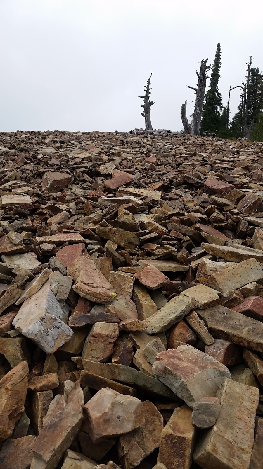
Definately got into a little snow


Above were pictures from the hike to McCormick, below are the ones I took on the longer trip to Josephine peak:

A little falsie of McCormick Peak

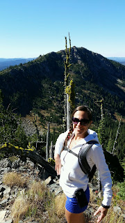
Trying to show how well-prepared I am when hiking alone


My selfie shortly before losing my phone
And one picture Jeff took on the way down. There's a smile on my face, so you know the phone is securely in my back pack at this point!
Showing off the beautiful color as it gets colder