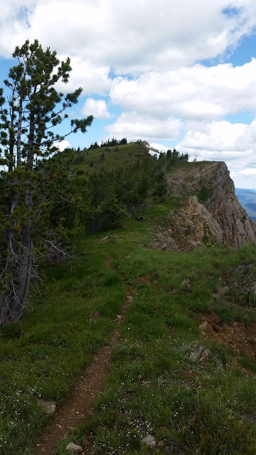
Unfortunately, on this day, the forest service had not gotten up here yet this year. The first half mile was covered in newly downed trees. Getting around, or over them, was a test in patience and a little pain management! I had to keep talking myself into going just a little more, as the trail opened up a little more every giant bunch of dead trees.
I actually read in the paper the next day how there was a planned hike up here, and to call such-and-such a number to go on it. I called and let them know how difficult that first 1/2 mile was, and it was highly appreciated! The gentleman I spoke to said he would get those USFS horses up there to get it cleared out. Wow! I hope he has that kind of pull!
So, after that first half mile, it was easy going. It was a pretty gentle grade up, and, as always, quite lovely. Mountains as far as the eye could see! It was less than a three mile hike, with an altitude gain of 1252, from 6295 ft. to 7547 ft. As you can see, not a difficult day.
 |
| First glimpse of the lakes below |
 |
| Larger, closer lake: Cliff Lake, smaller: Diamond Lake |
 |
| Still some snow on July 14th! |
 |
| You could only see Cliff Lake from the top of Eagle Cliff |
Since I felt this was a pretty easy hike, and I had time left in my day, I decided to drive down to the lakes and see how they looked up close. It's about a 9.6 mile drive to the turn off to the lakes, then 4 miles in from there. I highly recommend it. They are just beautiful! And Cliff Lake, the longest part of that hike, was only one mile in. Although, I will say, it was quite popular. I rarely bump into people mid-week (this was a Thursday) and there were 5 or 6 cars in the parking area. They all stayed at Diamond Lake, so we had Cliff Lake to ourselves.
Daimond Lake:


The hike between Diamond Lake and Cliff Lake just had the largest meadow of more different flowers than I think I've ever seen in one place. The pictures don't do it justice!
 |
| Looking back towards Diamond Lake |


Update! The gentleman I spoke with e-mailed me two days later and said they had cleared that first half mile of trail, and the hikers that went had a great hike! So, this should be a great hike for anyone now! YAY!


No comments:
Post a Comment