I give you fair warning right now. Although there were only three hikes, I feel like I have a lot to say about each, so this may be a longer read than you were anticipating....may want to just check out the pictures and come back to it when you have time for a novel! ;)
CIRQUE PEAK
For our first outing, I wanted to make sure I had a summit involved. After much investigation, I settled on Cirque Peak. I found from the moment we got in to Canada that I would be doing mental math on a constant basis...kilometers to miles, meters to feet. The kilometers I got down quickly, but for some crazy reason, I was thinking meters to feet (as already suggested) instead of yards, which makes more sense. Anyway, I was thinking this would be a fairly decent hike, but not too strenuous. As it turns out, it was over 10 miles roundtrip, with over 3000 feet of altitude gain. Doesn't sound too terrible, right? Well, it was a trillion times harder than I had thought. OK, that may be an exaggeration, but it was the hardest one we did on this trip. The first three miles were quite steep, but I wasn't bothered too much by that. It was a beautiful day, and I was noticing on our drive here that these mountains were majestic, so I was loving every second. The actual name of this hike was Helen Lake. 6.0 km one way with 455 m elevation gain. Let's see, that makes it 3.7 miles one way with 1492 feet of elevation gain. Since I only knew that part of the hike, but found you could hike to Cirque Peak from there, that was the plan. We walked through a lovely amount of meadow towards the lake, the whole while grateful for the much needed break my legs were getting, but also looking at what appeared to be a near-vertical hike up a mountain.

Well, it doesn't look as bad as it did in person, maybe.
Maybe you can see it better from the lake

This is above the lake, right before heading straight up Cirque Peak. We start on this side of the mountain, then, once you hit that ridge, go up the rest on the other side. I don't think the pictures do it justice though. This side was very much like purple sand. The start of it is obvious, but hikers kind of spread out and do their own thing after a bit. I chose to kind of side step my way up to about the middle of the mountain. I wish I hadn't. I thought the paths that went straight to the ridge line looked a bit scary, but the way I did it was so much worse. The footing was impossible, as every time you stepped, the ground kind of fell away underneath you. All I kept thinking was, "how am I going to get back down?" Once I finally made it to the ridge line, I looked back and could see that walking the other side of the mountain, although still quite steep, was so much less treacherous. It was like walking any normal trail, instead of the precarious steps I was taking. Well, I was at least pleased it wouldn't be too hard going back down. I do tend to make things harder than they need to be on occasion!
So up we went, and like I have mentioned, this was a VERY steep mountain. I was rather pleased to have solid ground under my feet, though, so I happily trudged on up. And that is when I realized it was too soon to let off my guard. The higher we went, the rockier it got, until we were again dealing with the ground falling away at each step. This time, however, it was rocks instead of sand. And because it was so vertical, I couldn't help but think about what the people above us were going to send down, and what I was sending to the people below. I was amazed at how many people were doing this, considering the amount of effort involved! Then I noticed something else....pretty much everyone had trekking poles. Ahhhh! What a great idea! In fact, I was downright jealous. I don't own a pair of these, but I did buy Jeff a pair a year or two ago, when he started hiking with me a bit more. He left them in the truck. Well, that'll teach us. I would have been happy to borrow one, had he indulged me!
Meanwhile, Xena, my ever faithful hiking companion, was starting to lose nerve herself! She was running all over in the sandy section, where I was wishing I had four legs as well, but the rocks were not pleasing her. I've dealth with this before. Not sure why she gets so timid on this kind of footing, God knows she does a thousand times better on it than I do, but she got to the point where we couldn't coax her up any further. If you noticed in the earlier pictures, there are no trees on this mountain. Had there been, I would have resorted to what I've done in the past. Tied her up in the shade and moved on. This was not an option. I'm very sad to report at this time, that I didn't quite make the summit. It was right there. Maybe 100 meters of more walking? I think less than that, even. It was sooooo close! On the happy side, I don't think the pictures I got could have been any better than at the top. I was blown away by the beauty of it all. I had no real idea what I was in the midst of, till I saw all of these glaciers. Just awe inspiring!
 |
| Looking down our path, now can you see how steep it is? |
 |
| This is the section where the walking was not even scary |
 |
| Can you see the lake above, the one where the glacier melts right into it. The color was bright turquoise! |
 |
| The panoramic.....never as good as the real thing. Wish I could fold out your computer to three pages! |
 |
Xena playing in an upper lake
|
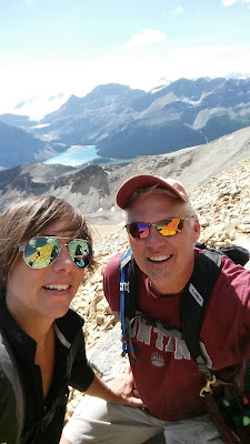 |
| Little Almost-Summit Selfie |
 |
My hand, covered in dirt, because
crawling a good portion of the way
up was mandatory |
The next day took us to Sunset lookout. Before going on this hike, we drove up into Jasper National Park to see if there were any vacancies in Icefield Centre. (A shower was desperately needed by day three!) Nope, it was too much to hope for, really, but we had had such good luck with campgrounds, it was worth the try. It was also worth the drive, seeing these glaciers when we got there. Wow seems like a worthy adjective at the moment!
SUNSET LOOKOUT
From what I read, Sunset Lookout is an old fire lookout. I was a bit disappointed that there was no lookout tower here. I don't know why, but those old rickety towers are just that cool. I'm not sure if they took the tower down or if it was just a lookout. I know I read "tower" somewhere!
This one was 4.5 km one way with 390 m of elevation gain...the mathematical conversion being about 2.8 miles one way with 1280 feet of elevation gain. Should be an easier hike than yesterday, right? Well, I will say it was shorter, and therefore "easier." Also, the ground was stable the whole way, so also easier in that capacity. The truth of it, though, is that it was just as steep a climb as the day before. Maybe steeper. Even though I didn't have any cell phone coverage in the parks, I had turned on my navigation app, because I knew I could at least record the mileage and elevation gain. What it told me was that, in fact, it was a total of 5.2 mile hike, with an elevation gain of 2032 feet. The mileage (kms) I read was about right, but the elevation gain was quite a bit off. 2000 feet up in 2.6 miles is a serious, non-stop work out on your legs, up and down. I had no problem with that, but I could definitely feel my muscles at the end of this day! And shorter though it may have been, the views were, again, just outstanding! This, I should also mention, was in Banff, as the Cirque Peak hike had been, but it was just south of Jasper, where I had kind of wanted to get a hike in, but changed it to this one. Partly because our schedule was going to take us to Auburn, WA (just outside of Seattle) and I decided I wanted to take two days for that drive instead of one.
 |
| Pretty, and very loud, waterfall |
 |
| Not quite there yet, but do you see the glacier on top? |
 |
| Another panoramic, because I want you to see it all as I had |
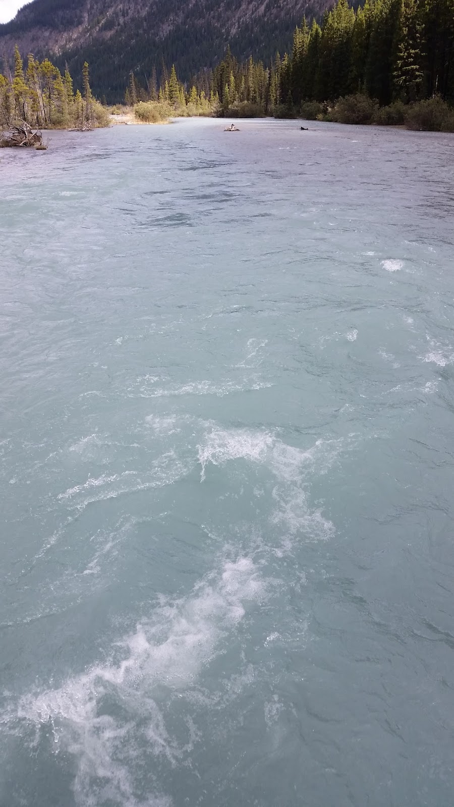
Meanwhile, I keep trying to get a good picture of the water. I can only describe it as a beautiful, milky-turquoise. The camera on my phone couldn't quite capture it. Shoulda brought the GoPro!
GREAT GLACIER
We drove on after Sunset Lookout and stayed in Golden, BC. This, I knew, would give us time to hike in Glacier National Park (in British Columbia, not to be confused with Glacier National Park in Montana), and still get some driving in towards Auburn.
Once there, we settled on hiking Great Glacier. This was a very different hike. For starters, we came upon this sign:
Only being a group of two, we waited to see if anyone else was going to hike this one. I really didn't want the fine, but more importantly was the other sign here:
This was August 19th, and that last post hadn't been put up yet (I took this picture after our hike). As you can see, Great Glacier had seen some bears recently. The "Griz" on Aug. 15 gave me pause. And truthfully, all of these hikes are quite close in proximity, so all of the wildlife observations were making me a touch nervous.
After waiting a bit, we finally had a threesome who was planning the same hike. Yay! I was just about to give up hope when they walked up! Introductions were made, and off we went to hike with Dan, Melissa, and Ally. I was relieved to have extra people to hike with, and we began chatting as we walked. I was probably doing most of the chatting, as I was thinking in the back of my mind,"I don't want to scare a grizzly, so if I keep talking, he'll hear me coming and move off."
They had done a tour to Glacier House the day before, and shared what they had learned about it as we passed by it. I love hearing the history of my surroundings, so this was very cool! I also found that Ally was just about as good a talker as I am, so I was feeling pretty good about not startling a bear today. I learned that she was 5 and 3/4 and about to start kindergarten. We talked about everything from her neighbor's dog, who sounds much like Xena, to having pockets in your shoes, to tuck in the laces. Yup, she had the same brand of hiking shoes as I did. Too funny!
 |
| Cool looking staircase of stone |
 |
| Sir Donald |
 |
| Rivulets of water carving out the stone |
 |
| I was being directed to point at the mountains....I kind of missed the mark? |
 |
| Our hiking partners |
 |
| Jeff, Dan and Ally chatting |
 |
Not sure I've ever seen this
kind of sign before |
During this whole trip, I kept thinking, "Wow, the streams are flowing so strongly still," and I had to keep reminding myself, there are SOOO many glaciers feeding them.