Thursday, May 20, 2021

Sweathouse Falls

I did this hike once in the Fall of 2020, and then again in the Spring of 2021. Obviously, they were quite different. In the Fall, I ran into a bird hunter, who was very respectful with his gun as he passed me and we chatted for a moment (you never know if you're bumping into a crazy person...after all, Ted Krazynkski lived in Montana) and the water was quite a bit lower, which wasn't all bad, when you read on.

This Spring, however, the water was rushing, which made the falls quite a bit more majestic, but you wouldn't want to get close to it, much less in it, as you'd be washed downstream in a big 'ol hurry, and the rocks against your head might guarantee an unscheduled interview with God.

I got there two different ways, the first being well studied before I left the house, the second, erringly, going by a quick internet read and memory. Not my best moment in hiking history! Either way, it's easy to get there, depending on from which way you're coming. From Missoula, right as you come into Victor, you will take a right onto Meridian Lane. Take a left at Sweathouse Creek Rd, which will take another left, then right. You drive right through someone's property, but rest assured, you'll know when. There's a giant sign that reads something like, "YOU'RE DRIVING THROUGH OUR YARD, PLEASE SLOW DOWN."

From Hamilton, you'll take something like Bear Creek Rd. to Red Crow Rd. to Sweathouse Creek Rd. It was a bit more convoluted, as Red Crow Rd. does some weird 90 degree angle turns, and then you don't know if you're on that, or Pleasant View Rd. The Meridian to Sweathouse Creek was a lot quicker and straightforward, no matter what direction you're coming from, in my humble opinion.

The hike itself is quite short. A little over 2 miles with a subtle elevation gain. It gets a little steeper towards the end, but easily manageable. I kept thinking to myself, "Self, this would be a good hike for someone not used to Montana's elevation." Most of my relatives live at sea level, and I'm always hoping they will eventually come out for a visit. Side note~my nephew started playing minor league baseball for Great Falls, so I feel like I have a way better chance of my sister and brother-in-law making out this summer. (YAY!)

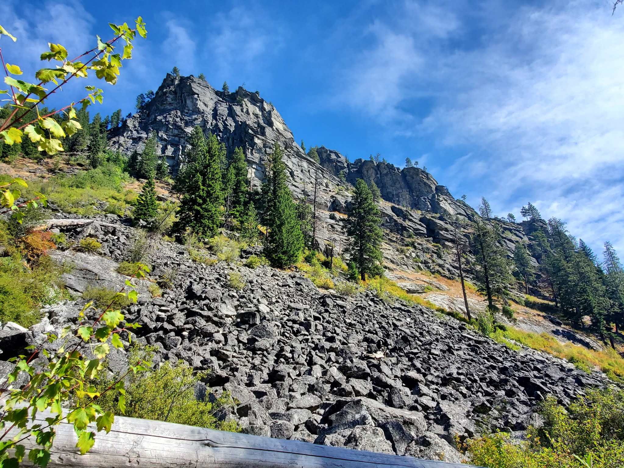
I'm going to post the pictures from both hikes, and caption them to let you know why doing this hike both in the Spring and Fall is a wonderful idea! Even though there were a lot of  cars, ie: hiking parties, on this trip, hardly any were actually at the Falls at the same time that I was there. I would be remiss if I didn't tell you that there are actually two falls. I noticed both times that a good amount of people stop at the first and head back. I think that's an awful idea, and the hike to the second is very quick. I will try to give you more info. about this hike in the captions. 


The parking area isn't clear but these signs are there, which makes it a little more obvious. You start walking up the road, when you meet two gates. The black one to the right is the one you want to walk around and go up that way. You'll still be on a gravel road. It passes by an old mine, I believe, before it turns into a trail. I was a little worried at first, that I was walking onto someone's property. 


These are from this Spring. The water is raging. (Sorry about the fingers!)


Spring~ First Waterfall

Along the trail


You can see some mining, I don't know, rail? I don't acutally know. If you want to explain it to me, that would be great!

This is the same pool, at the top of the first falls. The first is from the Fall, second from the Spring. I bathed in it last fall, but was scared to get too close this Spring! When I first came upon it last Fall, there were two ladies having lunch. I was a little sad that I couldn't enjoy it, but soon realized the trail kept going, which is what I did. When I came back down, they had moved on, so I had it to myself (with my hiking companion, Xena, water loving doggo of the world)


Ahhhhh, I love the perfectly clear mountain water! *Spring


This is the bottom of the second falls in the Fall
And this is the same spot this Spring


Wednesday, September 2, 2020

Hub and Hazel Lakes

 I found this hike through a patient of ours who took a little time quizzing me on where I've been so far. He's out there hiking a lot and he threw out so many good ones, but nothing new...until he hit on this one. I was so excited!!! After giving me the basic instructions, I got home and googled it, and did it the next week end. 

So, driving instructions first: Coming from Missoula, you head west on I-90 to exit 25. Get off there, then get back on the Interstate east bound, and get off on exit 26. Don't know why they don't have an exit 26 from the west bound lane, but there it is. It's a funny little circular exit that just turns around and puts you back on the Interstate if you don't get off in time. You head straight up the road for a little over 6 miles. Don't take the first right, right off the exit. This road is an easy, well kept gravel road. The trail head is right on a switch back and well signed. There were only 5 cars there on a beautiful week end, so it's not a busy trail at all. And one of the hiking groups was just getting back to their car when we were parking.

The trail goes through an old cedar forest. It was something out of a fairy tail, so pretty. And the first mile or so is super easy. The next mile and a halfish is a different story. Pretty stinking steep! In the middle of this part, there is a fork in the trail. There's a sign that points towards the lakes, but it still wasn't completely clear to me because of it's positioning, and the fact that it didn't show at all what the other trail might go to. So stay on the right fork to get to the Lakes. I believe the other trail takes you back to the access road, and I'm not sure, but it may take you all the way to Idaho, from what I've been told.

Once the trail starts to even out, the rest of the hike is mostly not hard, depending on what you do. When you come upon Hazel Lake, you can see it's a straight hike down to the lake. Very steep. We decided to just keep hiking to Hub Lake, as I was thinking I'd hit Hazel on the way back. Once you get past Hazel, which is a fairly big mountain lake, the trail gets a little bit steeper, but not too bad. Then it turns down for a little bit, and before you know it, you're at Hub Lake. The mountains around it were like giant walls keeping the lake in it's bowl. After hiking it, we were told there was an old mine, if we had kept on the trail and walked to the other side of the lake. I'm pretty disappointed  I didn't know that before. I think it's right behind me in one of the pictures. 

After hanging at the lake for a bit (there WERE fish jumping, but Jeff forgot his fishing pole for some ridiculous reason) we headed back. I wanted to take some pictures of Hazel Lake. However, I slowly talked myself out of it. The little hike down to Hub lake was steeper than I thought, and I knew the trail down to Hazel was WAY steeper and longer. Not out of the question, but I haven't been hiking as rabidly as I have in years past, and I was a little tired of all the steepness, and honestly, I had and IPA calling my name REALLY loudly.

As I am writing this now, and just uploaded all my pictures, I realize I didn't take nearly as many as usual. Sorry, out of practice, I guess. In the end, it was less than a 7 mile round trip hike, with only 1706 of elevation gain. That's quite a bit different from what I had read, which told me it was more like 7.2 miles RT with about 3500 of elevation gain. I'm not sure where that came from, but as you can see by my navigation app, which I trust indubitably, that is not so. 


My little piggies are in the water!


Saturday, November 24, 2018

Fred Burr Resevoir

For whatever reason, this will not post at the end instead
of the beginning. So, here are the stats, before anything else.
I was planning on hiking in the rain today, but when I woke up, we had several inches of snow. Erg. Well, I took my time getting ready, eating breakfast, etc., as to make sure the roads down the Bitterroot weren't dangerous. They were still a bit slushy as I headed down after 10:00 AM, but I made it there fine. As I drove down, it seemed like there was less and less snow than I had seen in Missoula, so I was getting hopeful. That was a touch too soon. Driving up Bear Creek Rd., there was more snow. Then, taking a left onto Red Crow Rd., there was even more. Apparently, it turns into Fred Burr Rd., but you'd never know. This is where the snow started getting a little deep. Thankfully, my Jeep sits high enough I didn't have any problems, but I still worry about driving mountain roads in the snow. 

As I got out of my Jeep, I realized I was going to be doing a lot of trudging today. It didn't bother me too much, as I was full of energy. The only thing that worried me at this point was whether or not I was going to be able to make out the trail. This was fresh snow, and not another soul to help lead the way. Also, I had read that some of it stays on the service road, but some of it goes off, and you have to keep aware. 

Off I went, and it was probably about half way there that I started thinking about my muscles. The amount of resistance the snow gave me wasn't such a big deal, until you're doing it for a couple hours. I kept thinking, "Boy, they're going to have a few words for me tomorrow!"  

I read that the hike was 9.7 miles round trip. My navigation app tells me it was more like 9.1. Not a huge hike, and not a ton of elevation gain, but, as I mentioned before, a much bigger work out than I had imagined. And by the way my dog is acting, you'd think I made her run a marathon! She's OUT! 

I'm excited to do this hike in the summer. Not because it's anything more wonderful than the next, but because I want to try to get to Fred Burr Lake. It's going to be more like a twenty mile hike up into a canyon, with a big elevation gain at the end, and the cool thing is it ends just shy of the Idaho border. I just want to be able to say, "I walked to Idaho."


These were helpful, until they stopped. If I didn't have my
navigation app, I would have started walking in the wrong
direction.  Fortunately, that would have put me back on the
right trail, just a longer way to get there. 

Snow was a little deeper than
anticipated

A bridge for cars, I believe, but don't take it, just keep going straight.

Perfectly packed snowball

Take this trail. I wasn't sure why
at first, as you just end up on the
same service road. I assumed it was
because it went through private property.


Tiny waterfall

That mountain in the middle....Idaho/Montana border

As you can see, the "resevoir" is but a stream at this point in the fall


Can you see the cabin? This is where the sign has you go up off the
service road. I didn't see it on the way up. It's right on the creek.
If you know who owns it, and if they want to sell it, I'M IN!


Thursday, August 2, 2018

Goat Mountain

First of all, I'll just tell you how to get there, then I'll tell the story of this hike, and you can decide after that if you'd ever want to try it.

South of Hamilton, 3.5 miles, take a right onto Roaring Lion Rd. About 2.5 miles in you come to this sign (shortly after the road becomes a dirt road):


You'll take a right here and there is a circle with a few parking spaces. At this sign you'll start the short bit down and over the bridge that spans Roaring Lion Creek.


Now take the left trail straight up:


Not this one (which goes along the creek):


Now for the nitty gritty. This is a "short" hike. It was only 1.31 miles to the top, or the spot where I stopped, because the ridge line would have been too dangerous after that. The kicker is, it was the STEEPEST hike, thus far, that I've ever taken. A "normal" steep hike, if you've read anything I've written, sends you up 1000 feet of elevation per mile. I've been on quite a few of those. This one, at just 1.3 miles gains you 1660 feet of elevation. It was straight up, the whole way, no breaks. I definitely walked the slowest I've ever walked, and took a lot more breaks than I normally do. I gave myself the OK, though, because I haven't done a lot of summit hikes, as in years past, and so wasn't in the same shape. It was a very hot day, on top of that, and the amount of water pouring out of me was epic. At one point, I squatted down, to get my heartbeat back to normal, and when I stood up, got dizzy enough to sit right back down in the dirt and take a proper break. Ugh, I'd hate to faint up on a mountain with no one around...that could be a big oopsie! 

I made it to the top, my dog plopped down in the shade, and I took my normal pictures. Unfortunately, it has gotten a bit smokey from the fires on the West Coast. I'm glad they aren't right near us, but getting the smoke doesn't make it that much more enjoyable. The jaunt down was quick and fairly easy so I decided to walk along the creek for a way. As I walked, I thought I'd message a friend who lives in Hamilton, to see about a quick visit. As I started writing, and proof reading, I realized I had written a bunch of gibberish. Oh, no! I was incredibly scared as to what was going on! I couldn't figure out the words I was really trying to say, or if I had spelled anything right! I calmed down, drank more water, and finally got it out right. Whatever happened had passed. I went straight back to my Jeep, got in and drove to the first Town Pump and got a cold drink. After getting home, I googled "heat stroke," as I was worried this was a possibility, and sure enough, the confusion, profuse sweating, and raging headache were all symptoms. Upon reflection, I probably should have gone straight to the ER, but like I said, it passed quickly. I'm writing this just a few hours after getting home, so you be the judge....am I making sense? I hope so! 

All in all, I think if you want to do this hike, it's worthy of your time. However, do not attempt it on one of the hottest days of the summer! A side note; this whole area was burned two years ago (again) and there is zero shade. Nary a live tree even existed, so just be aware of that. 

Sheafman Point, still the most hated hike I've ever taken!


Looking down at my feet, being careful, I walked right into
 this limb!
:P

Goat Mountain as you drive up to it


What my feet and ankles looked like, after walking through a
burned forest. I was actually wearing my trail runners, so was
surprised that my toes were black, as well